WOW! This morning before I went to work, Larry showed me an amazing (and frustratingly non-intuitive) website from Minnesota's
Department of Natural Resources (DNR). Evidently, beginning in 1930, chunks of the state were mapped from the air.
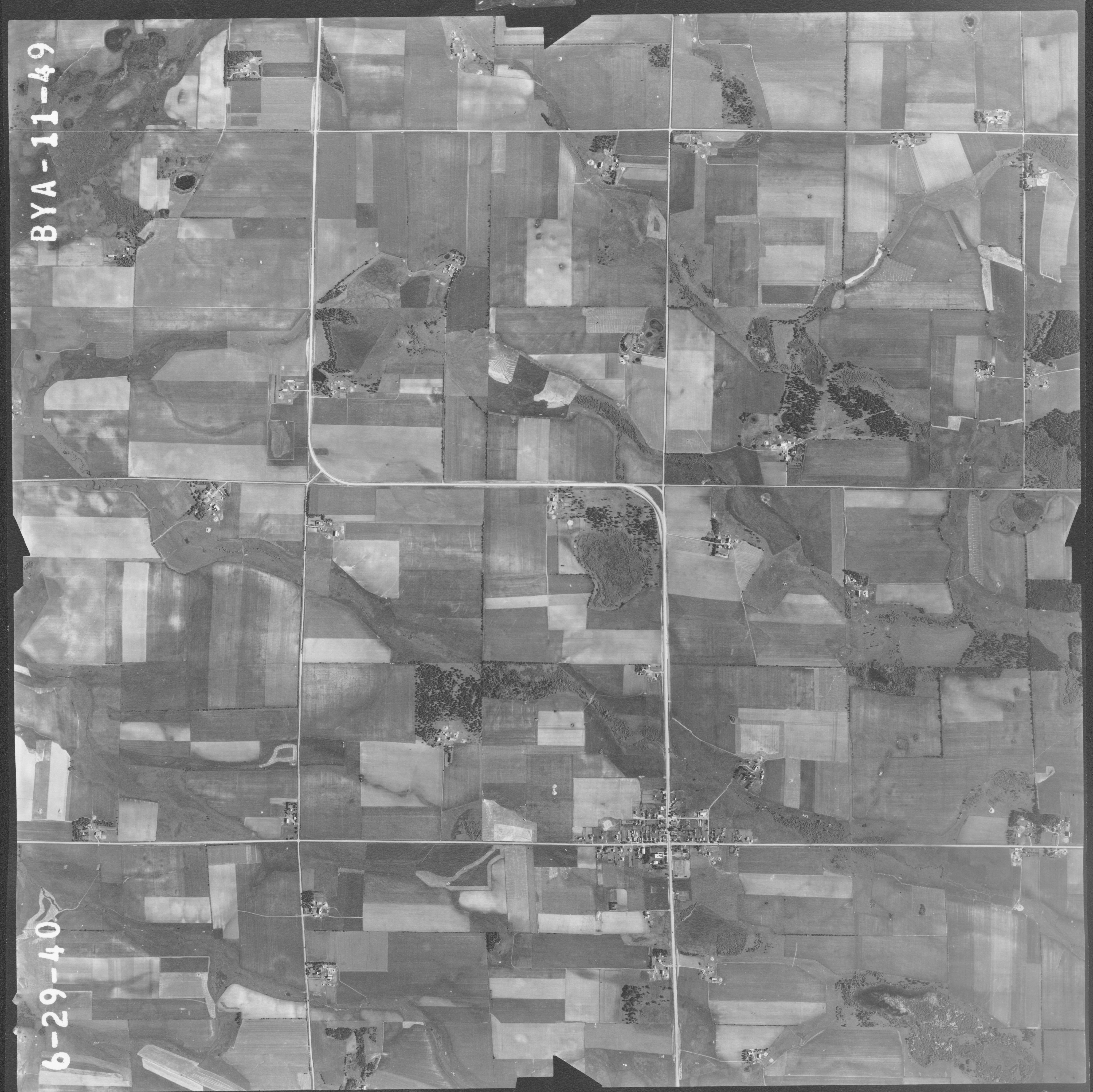
Of course, we tried Morrison county--nada in 1930, but YES! in 1940...this is the whole section--find the jog in Highway 25 to orient yourself, ok? (The link above takes you to this page).
Now, on the actual site, click on the place you want magnified (like the village of Buckman...lol), and you'll find this:
Isn't it just magnificent? Some buildings we grew up with were there in 1940 (St Michaels, the Hall, the Creamery, Zenners) and MUCH has changed since then...but to look back like this is stunning.
Dad was 27 and hadn't left Buckman for the Army yet, the city hall was being built, the school had no addition, and look at the tiny pine trees on the north side of the church lot. And WOW--no ballpark!
The photo was taken in the early morning (see the shadows on the highway?)
Does anyone know who owned the farm in the upper right corner?
A HUGE thank you to Larry. OMG, what would we know without HIM?


